Western Navigation and Cartography
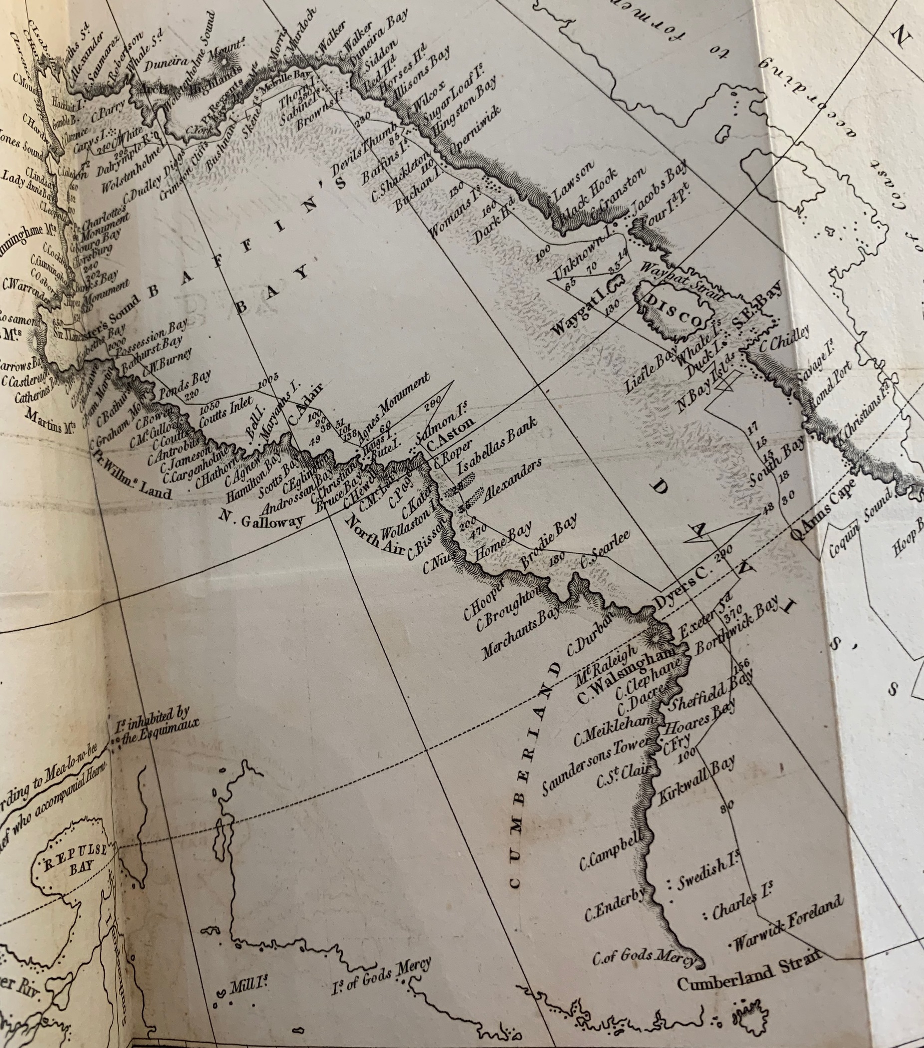
In 1818 Captain John Ross departed England as commander of the Isabella in search of the elusive Northwest Passage. He sailed counter-clockwise; a thin black line on the map traces his route. This map was published in an account and defense of the mission a year after Ross returned to England. Although the expedition produced the most accurate map of Davis Straight and Baffin Bay to date, it failed to achieve its goal. When John Ross arrived at Lancaster Sound, which is now known to be the eastern entrance to the Northwest Passage, he mistakenly identified a mirage over the ocean as a mountain range. Ross named these imaginary mountains the Crocker Range and dismissed the possibility that Lancaster Sound had an exit. His decision to sail north out of the Sound instead of exploring the mountain range was met with resistance from much of his crew and ultimately ruined his reputation.
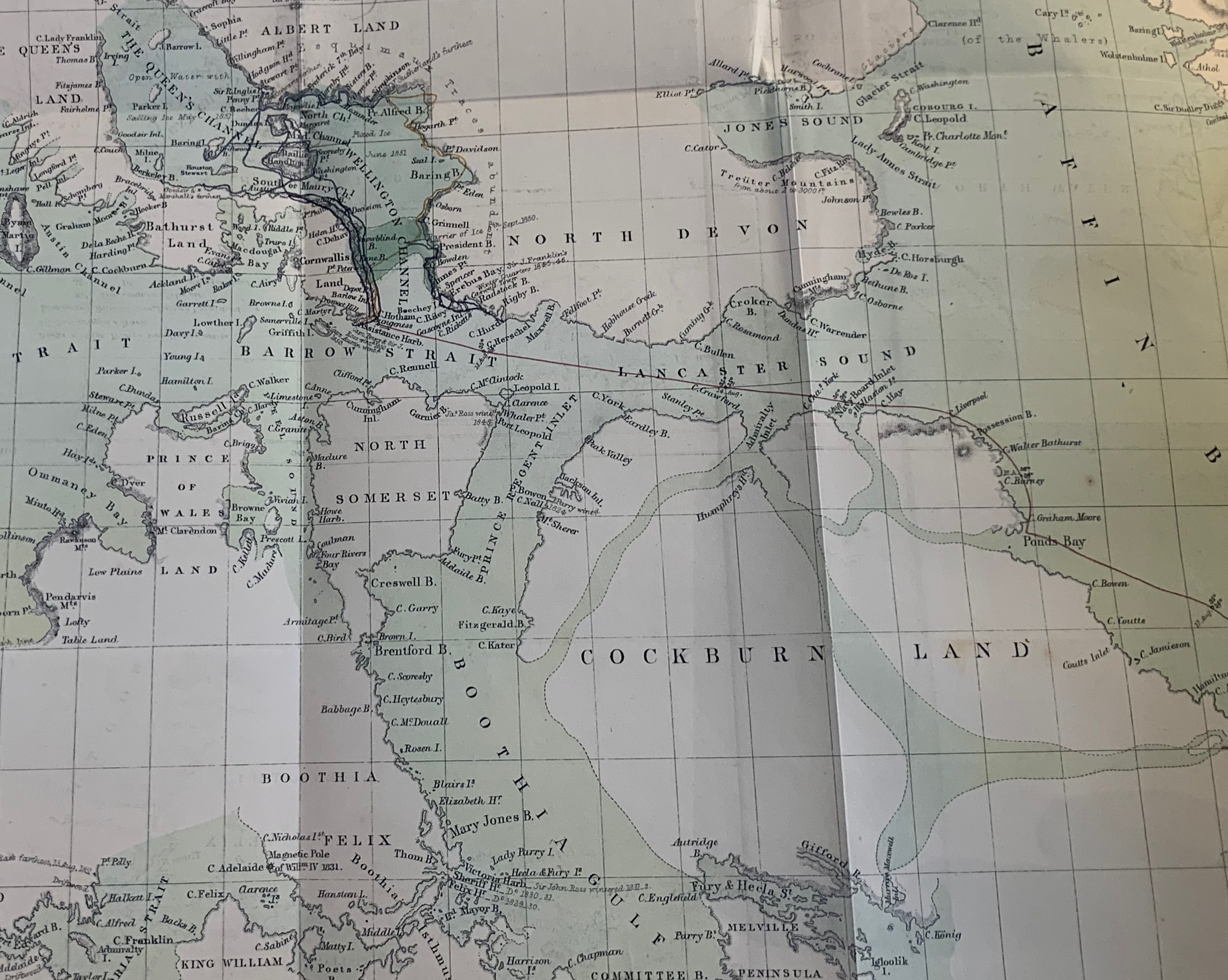
This map of Baffin portrays the route taken by the H.M. ships “Lady Franklin” and “Sophia” from the year 1850-1851. Specifically, this map shows Lancaster Sound and the entrance to the Northwest passage that John Ross dismissed as a mountain range. This map was published as part of a larger account of the voyage. The purpose of the expedition was to find Franklin’s Lost Expedition, a pair of ships, the “Erebus” and the “Terror”, that had gone missing with a crew of 129 in 1846. This expedition was unsuccessful in locating either ship. However, Dr. Sutherland’s account of the expedition and the attached maps and illustrations contributed greatly to the Western field of Arctic knowledge and navigation. It has since been discovered that Franklin’s expedition became stuck in ice off the coast of King William Island in September of 1846. The ships remained lodged through the spring of 1848 at which point the crew (without Captain Franklin who had died in June of 1847) attempted to walk to Back River, the nearest Western Civilization, but every crew member died along the way.
In his book “Journal of a Voyage to the Northern Whale-Fishery,” the British explorer William Scoresby documents his experiences and observations of the Arctic during a whaling expedition. The book offers valuable insights into the harsh environment and conditions, along with an insight into Scoresby’s navigation techniques. Scoresby describes celestial navigation, which utilized the quadrant and chronometer instruments to navigate by stars and planets by determining the ship’s latitude and longitude. He also used the “dip sector,” which measured the dip in the horizon through the angular difference between the actual and apparent horizon and provided distances between the ship and nearby land and ice.
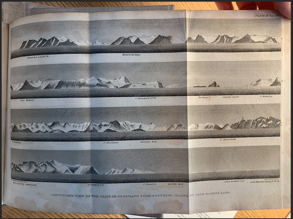
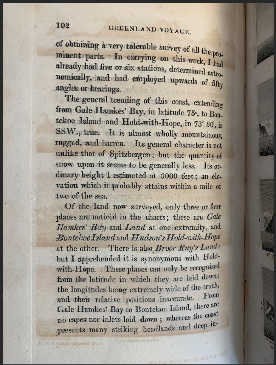
Scoresby utilized ice observations and coastline drawings to create detailed charts and maps of the Baffin Bay region. His entries on the various characteristics of ice formations, such as their shapes, sizes, and movements, assisted in navigating and understanding the Baffin Bay region. For example, the drawings on the right depict multiple renditions of the Greenland coastline, which were often similar in appearance, and required detailed depictions of the headlands with corresponding latitude data for differentiation.
Although the coastal landscapes appeared similar initially, Scoresby learned to construct the sketches through color, mountainous or flat terrain, ice or rock-covered land, and land contour. These differences allowed him to differentiate the rugged and barren coastlines for navigational purposes. To separate the locations, Scoresby also named inlets, capes, and islands as he explored, deriving the titles from peculiar characteristics in the land along with respected friends from home whom he wished to pay compliments.
The coastline drawings to the right depict the coast of Greenland from Bontekoe Island to Gale Hamke's Bay, and are part of a collection of sketches and journal entries that Scoresby includes in his journal on the expedition. This trip was called the Scoresby Expedition, and took place during the years 1822 and 1823. Through the trip, Scoresby studied the geography, climate, and natural history of Greenland's coasts. His detailed maps and measurements of the fjords, glaciers, and icebergs in the region were significant contributions to the understanding of the Arctic region during his time period.
The Scoresby Expedition ultimately played an important role in expanding knowledge about Greenland's coasts and the broader Arctic. Scoresby's scientific findings and detailed charts improved navigation in the area and set the foundation for future explorations and scientific research.


