-
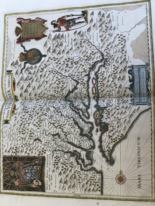 Nova Virginia Tabula
 "Nova Virginia Tabula" is a map of Virginia by Herman Moll in his written work "The World Described." Maps offer an interesting historical perspective because they often show what the map creators considered were important. In this case Moll's map provides a detailed visual representation of Virginia's settlements, especially when it comes to those of indigenous people. The map also consists of illustrations of indigenous peoples. The illustrations depict the natives as technologically backwards but also as noble and proud. This perspective of indigenous peoples was popular during the early colonization of North America and it often led to belief that the natives should be both christianized and civilized by European colonists. Hakluyt argued that the English should colonize in order to prevent the Spanish from converting the indigenous communities to Catholicism before they arrived. The map also has an illustration of what seems to be an indigenous gathering titled, "Status Regis Powhatan" or "The Status of King Powhatan." Powhatan is depicted as powerful and respected with many subjects gathered at his court. -Henry
-
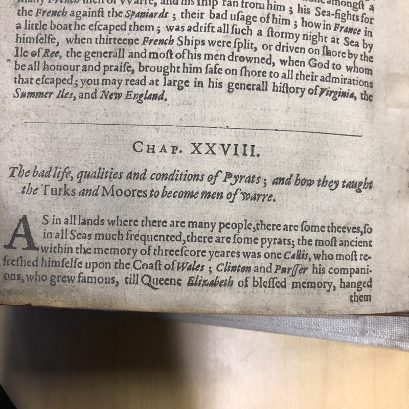 The bad life, qualities and conditions of Pyrats; and how they taught the Turks and Moores to become men of warre
 Propagandized account of how English pirates influenced the Moorish and Turkish militaries in the late 16th and early 17th centuries. It is by title a description of how English Pirates influenced the Turks and Moores, but in reality is blanket criticism of their purpose and way of life. Smith in his account of pirates resorts to name calling and paints the pirates as scum and villains. He ascribes to them base characteristics and states they abandoned the plantation mission of the New World in favor of plunder. Smith in his closing remarks paints a picture of Carolinan and Virginian planters returning to England very wealthy, with the pirates teeming jealousy. The author is propagandizing the planter lifestyle in the hopes of, if not persuading pirates to abandon their vocation, then at least convince the public that farming was the better option.
-
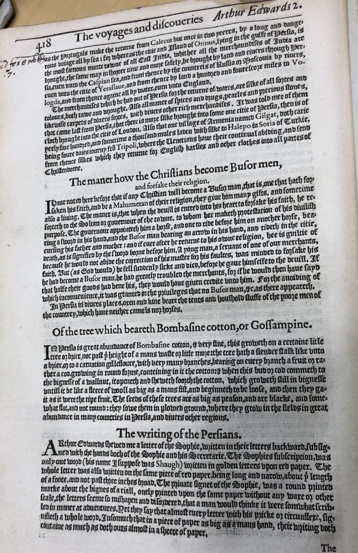 The manner how the Christians become Buforman
 Hakluyt in this paragraph is detailing how easy it is for an English man living in Turkey to adopt native religion and custom to the detriment of his own country's. The passage is inherently a warning against such heathen behavior and to not "go native." This story would go on to become a popular trope and add to the predominant outlook on English notions of cultural and religious superiority. Similarly, it served to cement the idea that religion determined whether you were English and consequently one's freedom. At the same time as Hakluyt published his book, James Thomson's "Rule, Brittania!" was incredibly popular in England. This song pioneered the idea that no Englishmen could ever be held in chattel slavery. As such the English had to turn to non-Christian and non-white people for slavery.
-
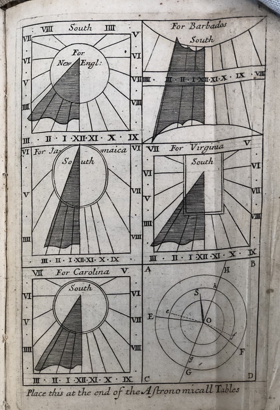 Sundial adjustment directions
 This item is a set of images designed to help the reader to adjust their sundial to measure time correctly. The audience is specific to New England, Barbados, Jamaica, Virginia and Carolina. These directions were novel in the sense that that they were a direct result of the England's imperial growth; as such they were the first of their kind. They show that empire had expanded into different time zones and sent their people further than they ever had before. England was now a huge actor on the global stage and its citizens abroad were growing accustomed to the new power. The fact that the book that it was in, "A History of New-England. From the English Planting in the Yeere 1628. Untill the Yeere 1652", was so widely disseminated provides evidence for this growing acceptance. This item is an interesting footnote in the early growth of Imperial England.
-
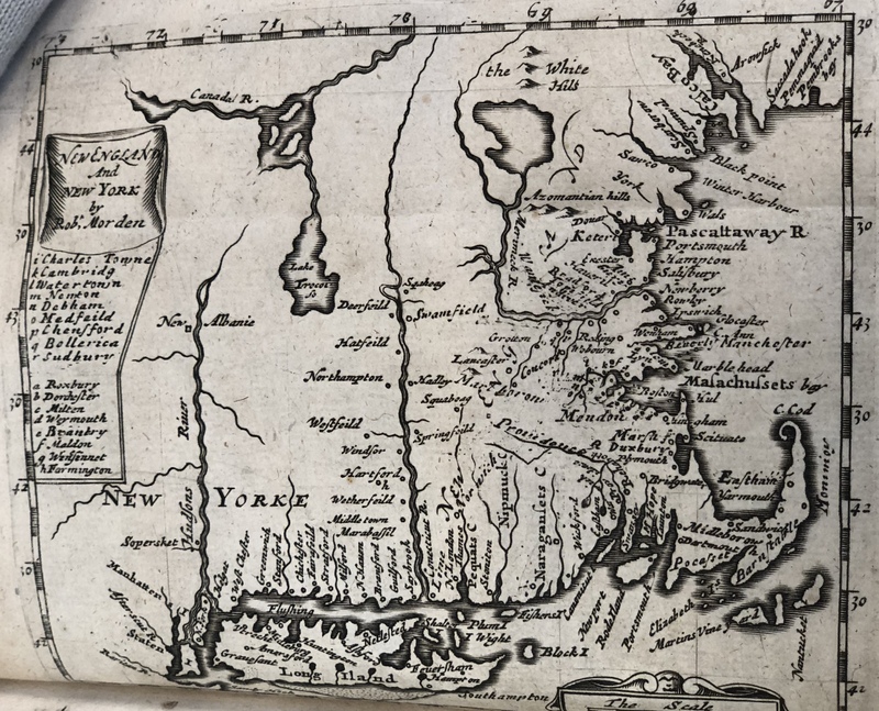 Map of New England and New York.
 A map of New England and New York created by Cotton Mather. Cotton Mather is the grandson of John Cotton, who was a puritan preacher that gave the sermon “Gods Promise to His Plantation” and It includes a scale (in English miles), a compass and locations of towns and villages, as well as geographical features. The map itself is not very different than previous maps because there weren’t very many developments since the creation of previous maps. The map is found in the book “Magnalia Christi Americana”, and it’s considered the first map of New England that was created in the 18thcentury. The “Magnalia Christi Americana” is a history of New England from its beginnings.
-
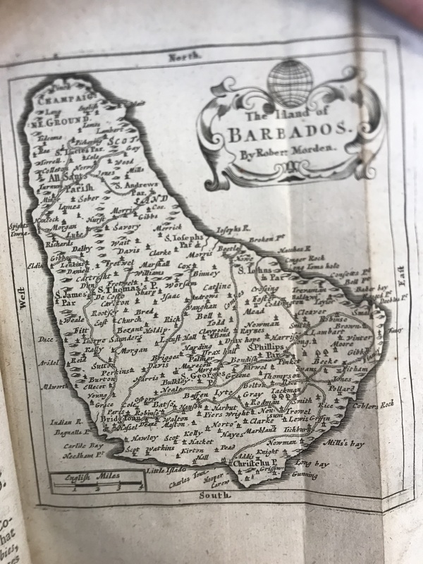 Maps of England's Caribbean Colonies (1677)
 The first map is a very simple map of the English colony of Barbados with all of the cities labeled. The second map is a larger map of the Caribbean at the time, with a map of Jamaica blown up at the top. The last image is the title page of the book, "The Present State of New-England." William Hubbard's book serves as an informative source on England's early colonies in the Caribbean and America. Hubbard's book is one of the earliest sources that provides a history of England's colonies from 1607 to the year it was published, 1677.
-
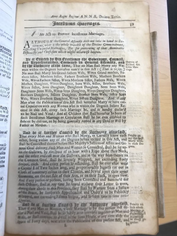 Acts & Laws of New Hampshire - Incest & Bastardy
 A 1716 law for the province of New Hampshire in New England that outlines the parameters of incest and the penalties for violating the law. The law on incest is very specific, defining all the possible relationships in which one might commit incest. If there is a marriage or child born of incest, such marriage or child is considered illegitimate or disabled. Violators of the law will be whipped, fined, and must wear the letter "I" on their clothes. There is also a separate law designed to protect bastard children and prevent their murders. The law makes it illegal for women or men to kill their bastard children in order to avoid shame or punishment.
-
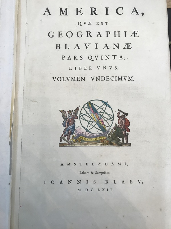 Title Pages of Joan Blaeu's "Geographia"
 The title page of Joan Blaeu's atlas written in Latin, "Geographia." Joan Blaeu was a Dutch cartographer, continuing the cartography legacy of his father, Willem Blaeu. The page following the publishers information is a drawing of the New World, "America." The drawing is centered around a naked Native woman with slaves working in the background, angels in the sky holding a banner that says "America," what appears to be Mary holding a cross, an anglo-european slaying a devil, and a ship docked in the background.
-
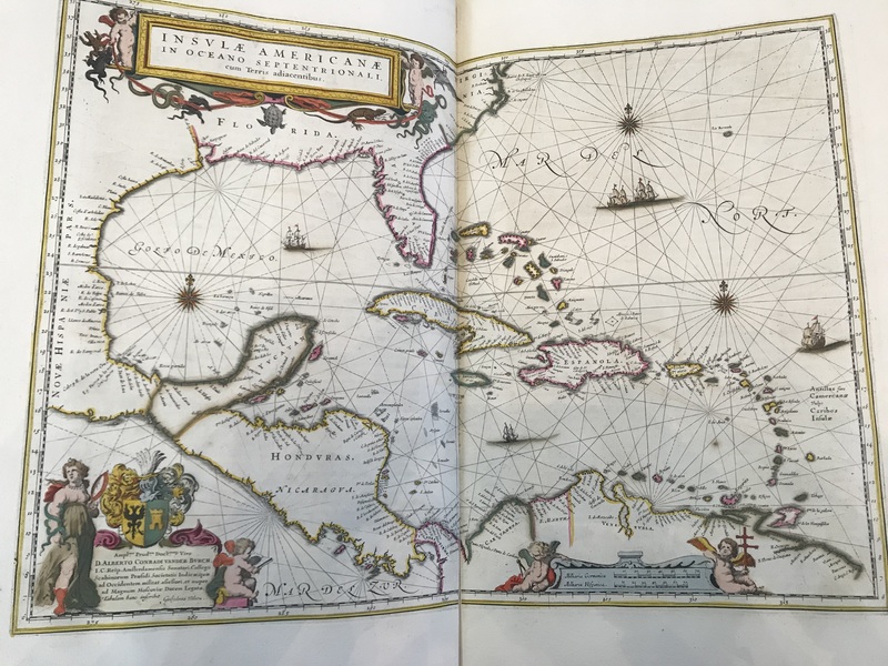 Map of the Caribbean (1662)
 A detailed and colored map of the Caribbean islands, Southern North America, Central America, and Northern South America. The map illustrates Spain and Portugal's dominance in the New World in the early 17th century. The colors do not seem to signify which European power controlled the colony; colors appear only to represent borders of each colony.
-
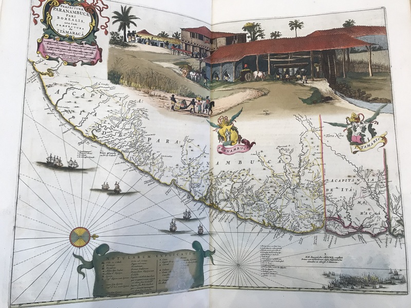 Map & Illustration of the Portuguese Colony Pernambuco (1660s)
 A map of the the Portuguese colony of Pernambuco that also includes a graphic illustration of the sugar production process used in South American and the Caribbean during the 17th century. The illustration shows the processes and early innovations in sugar production as well as the heavy reliance on African slaves. It is noteworthy to point out that although the main purpose of this image is to serve as a map of Pernambuco, the large and vivid illustration of sugar production above the map demonstrates the significance of sugar in South America at this time.
-
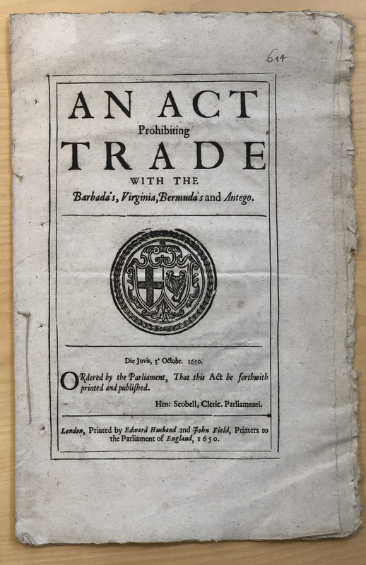 "An Act Prohibiting Trade with the Barbado's, Virginia, Bermuda's, and Antego
 This source is an act of parliament that prohibited trade with Barbados, Virginia, Bermuda, and Antego. The Act was passed in 1650 during the height of the English Civil War between the Parliamentary forces and the Crown's royalist forces. Many planters and colonists saw their loyalties to the Crown as superseding their loyalties to Parliament and therefore sided with the Crown in the conflict. This stance is the source of Virginia's nickname who dubbed themselves the "Old Dominion" in support of Charles II while puritans in New England saw their loyalties tied to the predominately puritan parliament. Royal support was so strong in Barbados that after the Parliamentary victory over Charles II in 1651, Parliament sent an invasion force to Barbados to reassert state control over the colony. It represented the beginning of a new level of state power. -Henry
-
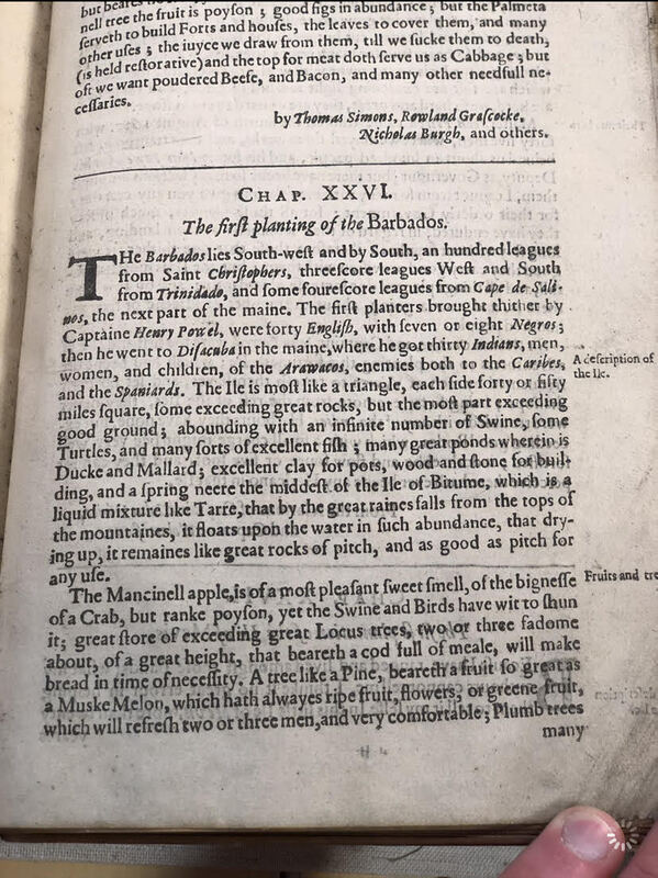 Chapter XXVL: The first planting of Barbados
 This item is a description of early colonization of Barbados by Thomas Slater in his work, "The True Travels, Adventures, and Observations of Captain John Smith." The account begins with a geographic description of the location of Barbados and then writes that the first group of colonists were brought by Captaine Henry Powel and that the group contained "forty english, with seven or eight Negros....thirty Indians, men, women, and children." This is important because it shows that enslaved africans were a part of the original plan for Barbados, unlike in Virginia, where slavery emerged more slowly. Slater then goes on to describe the island as a place of great bounty possessing, "an infinite number of swine, some Turtles, and many sorts of excellent fish ; many great ponds wherein is Duck and Mallard ; excellent clay for pots, wood, and stone for building." It is clear that Slater is using his written works to encourage future colonization of Barbados. -Henry
-
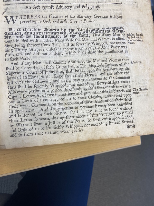 "An Act against Adultery and Polygamy"
 This passage is an act banning both polygamy and adultery in New England by the General Court or Assembly of His Majesties Province of New-Hampshire in New-England. Early colonial New England was a thoroughly puritan place and naturally it was a very strict and disciplined society. This act states, "Be it therefore enacted by the Lieutenant Governor, Council and Representatives, convened in General Assembly, and by the Authority of the Same, That if any Man be found in Bed with another Mans Wife, the Man and Woman so offending, being thereof Convicted, shall be severely Whipped." Most colonies followed English law based on precedent but the passage of a strict law against polygamy and adultery shows how much more involved New Englanders were in each other's personal lives than they were back in their home country of England.- Henry
-
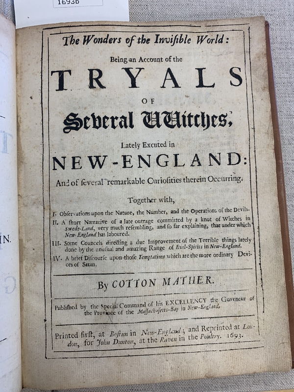 The Wonders of the Invisible World: Being an Account of the Tryals of Several Witches:
The Authors Defense
 Cotton Mather's observations on the trials of witches in New England. In the account of the trials, Mather aligns them to be devils. The evils the witches seek to spread are brought to a halt by the people of New England. Mather maps out the reaction of the Counsel to the activities of witchcraft, and sets out for improved action against the evil spirits that seek to bring down the English settlers.
John Cotton was a puritan preacher. Cotton originally gave this sermon in England, specifically Southampton, when John Winthrop and other settlers of Massachusetts were set to leave for the new world in 1630. In 1632, Cotton was summoned to the high court, and instead of appearing, he went into hiding until he was able to travel to travel to Boston in 1633. Cotton distanced himself from Anne Hutchinson and her supporters (Henry Vane, John Wheelwright) in order to stay in power. Cotton later married into the Mather family and his grandson is Cotton Mather, a prominent figure in New England for years to come. Cotton’s sermon was particularly important in justifying Winthrop’s adventure to New England. In a way, it was a justification of Winthrop’s venture, and it was an argument for English presence in the Americas. The sermon was also an encouragement for other people to emigrate as well.
-
 A History of New-England From the English Planting in the Yeere 1618 untill the Yeere 1652
 A mission statement for those spreading the Christian mission in New England. In this document we can identify the main goals of the English in their settlement. Outlined in the text are the acceptable means of behavior for the settlers. Their mission is mainly rooted in the establishment of community, and creating a heaven for the Puritan life.
-
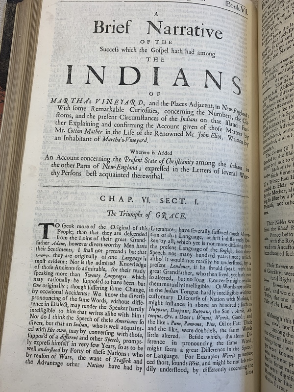 The History of New England Book VI.
A Brief Narrative of the Success which the Gospel hath had among the Indians of Martha's Vineyard, and the Places Adjacent in New England
 An account found within concerning the The History of New England discussing the successes of the English mission to spread Christianity to the Indigenous people of the New England. Their attempts to bring the Native people of the land into the light of Christ seem to be motivated to civilize the indigenous groups, and to instill in them the ways of proper Christian people.
-
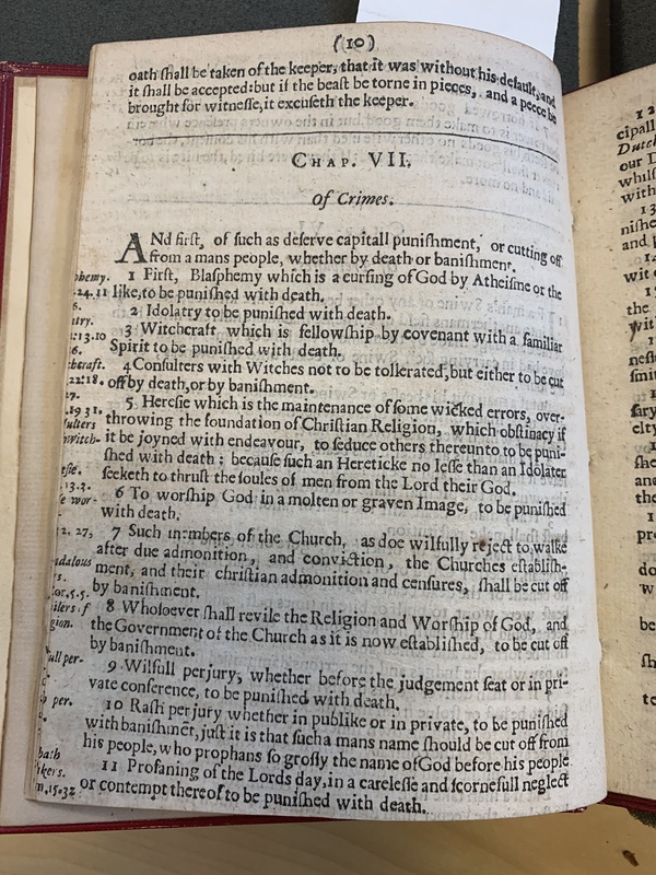 An Abstract of the Lawes of New England
Chapters VII-VIII
 In these documents we are able to observe the punishable crimes for the people of New England. The crimes are mainly focused on maintaining the order and civility of life in the settlements. Due to the intertwining of Church and Civil law we can see how life was centered around faith in the colony. Punishable offenses could result in anything up to banishment or death.
-
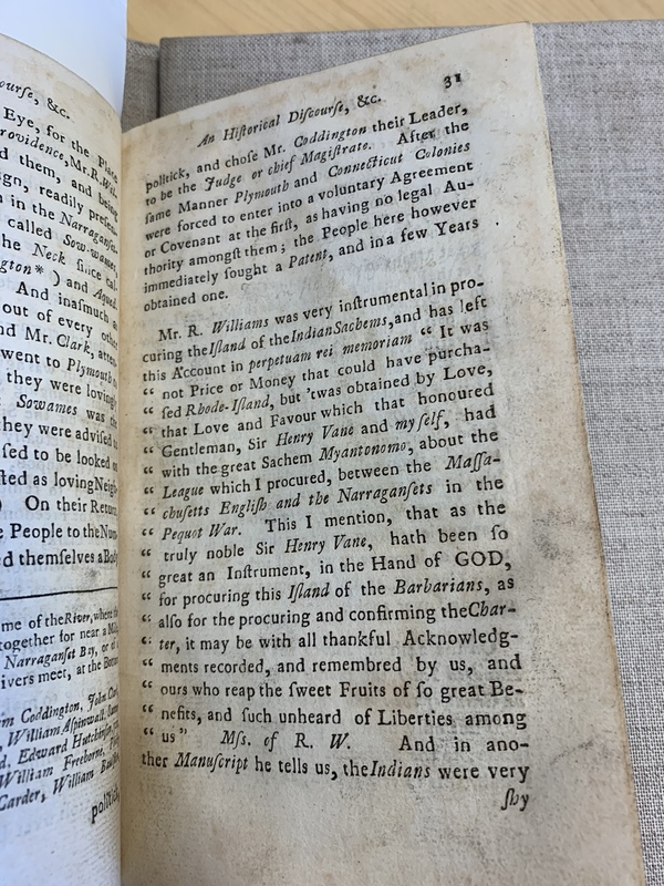 Roger Williams' Romanticization of Rhode Island History (Excerpt from Callender)
 John Callender, clergyman, historian, and Harvard graduate (at age 20; he started at age 13), wrote this history of Rhode Island, and in the shown excerpt is a Roger Williams quote about Rhode Island's origin. As you can tell by the text, this narrative of Rhode Island is highly romanticized, describing Rhode Island as "obtained by Love," rather than with good Indian diplomacy after a religiously motivated banishing from Salem. On a historiographical note, it is also notable that the practice of history in the 18th century had a much larger focus on interviews with participants in the history than historical narratives do today
-
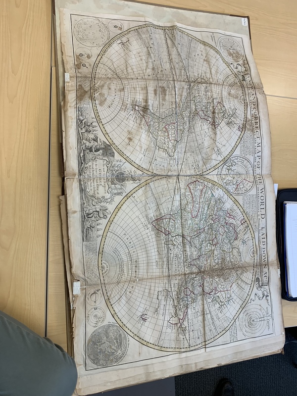 A New and Correct Map of the World, Laid Down According to the Newest Discoveries and from the Most Exact Observations
 This map by geographer Herman Moll shows the world according to mainstream cartography, and therefore, shows how literate and educated Britons saw the world. An interesting (and possibly ironic) thing to notice is that the map is declared to be according to "the most exact observations," yet if that is true, there is a dearth of exact observations, at least of the kind that would be available to a London cartographer like Moll. According to the map, Canada's Pacific coastline doesn't exist and Ethiopia is one big "Unknown." In addition to unknowns, there are big errors: for one, there is a depicted land bridge between New Guinea and Australia, almost seeming to form a new continent. Nonetheless, the fact that such a detailed map was able to be produced only a couple hundred years after the New World was discovered is a testament to the speed of early European colonialism.
-
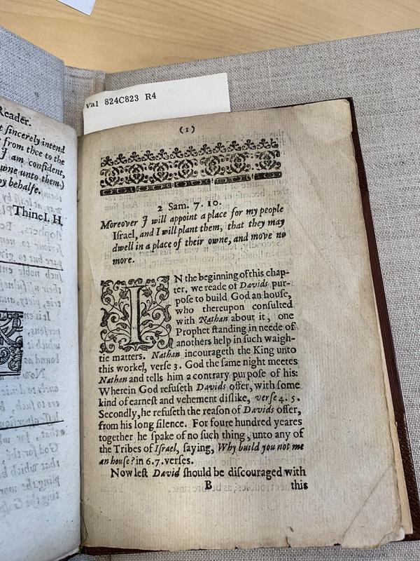 "Gods Promise to His Plantations" Section on Samuel 7:10
 These three pages are a section of John Cotton's sermon given to colonists settling Massachusetts. The sermon begins by quoting a bible verse where God promises to "appoint a place for [His] people Israel" where they will "move no more." The inclusion of this verse affirms that Cotton and the Puritans believed their quest to settle Massachusetts was both religiously motivated and divinely ensured. This worldview, where they are the clear protagonist, is one of the major reasons why Massachusetts Puritans saw King Philip’s War as such a terrifying moment for them. They thought, if God was on their side, and Massachusetts is Israel, why would He let them suffer?
In addition, Cotton uses the phrase “my people” to describe the Puritans, making it quite obvious that he believes the Puritans are truly God’s people, not merely all Christians, and certainly not all people.
-
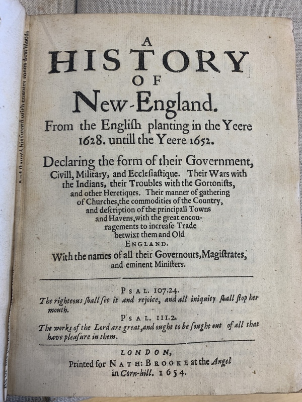
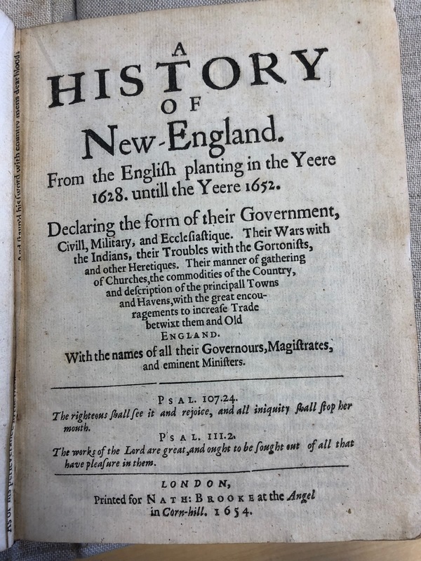 Title Page of A History of New England
 The document A History of New England which was written by Edward Johnson depicts many pieces of history regarding New England from 1628-1652. This book explores everything from the declared form of government to the push to increase trade between the colonies and England. This is significant because it demonstrates the importance of the factors that shaped New England. Many of the events, and components depicted in this book help to tell the tale of what made New England unique. The wars, forms of government, contacts with Indigineous peoples, and desire to increase trade all add to the formation of New England as an independent place. These are the events that helped to create a special identity that defined New England. (Brillante)
-
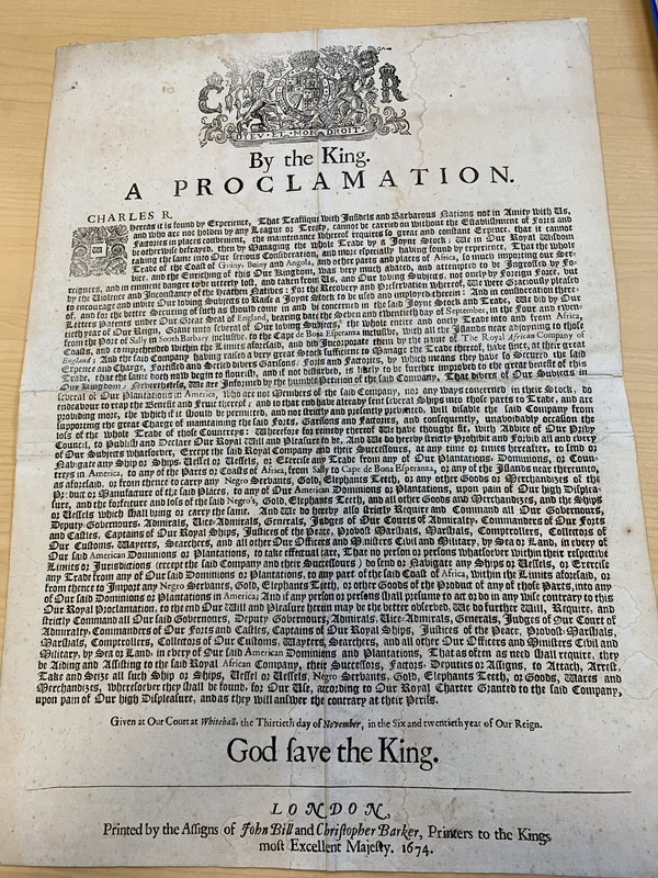 [A Proclamation Regarding the Royal African Company’s Monopoly].
 This document is the royal charter for the Royal African Company. It set up the jurisdiction of the RAC as extremely broad from "South Barbary [on the North African Coast] to Cape de Bona Esperanza [the southern tip of Africa]." Not only was that their jurisdiction broad, but the RAC was given an official monopoly on Anglo-African trade. The English’s actual and regulated participation in African trade (especially slaves) was a big deal because of previous Iberian and Dutch dominance in that sphere. It also represents another shift in English policy—how close they should be to the actual enslavement of people. When the English had merely bought or stolen slaves from Iberians, they never considered themselves to be “making” slaves, only taking slaves. They weren’t guilty of enslaving anyone, technically, and their ownership would surely be preferable over the cruel Spanish papists, which is how the English viewed the Spaniards. Now though, the RAC would be on coasts paying money to actual slave raiders; were they not becoming more and more responsible for enslavement? But they had reasons not to care about ethics anymore—by 1674 (the date of this charter), the Barbadian economy was taking off and all the other colonies’ outputs were growing too. Cheap, “expendable” labor was needed and the issue could not wait for pirates to take slaves from Spanish ships.
-
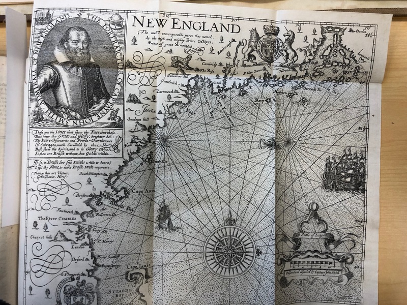 Map of New England found in The Generall Historie of Virginia, New England, and the Summer Isles.
 The map depicts the New England coast as described by Captain John Smith. This map was published in 1624, and shows all of the large established towns along the New England Coast. There are also depictions of large ships moving towards the coast, as well as a very large image of Captain John Smith in the upper corner. It is not so much the location of the towns that is important here, but instead what the creator of the map deemed important enough to place. The images that are depicted on the map explain a considerable amount of what they were trying to convey about the region. The somewhat embellished depictions of unicorns and leopards give an almost fairytale twist surrounding the entire region. Almost as though they are calling others to it. The map is so eloquently drawn that it is almost more a piece of art than a navigation tool. The large and imposing portrait of Captain John Smith also adds to an air of confidence and conquering spirit that embodied English motivation for colonization. (Brillante)
-
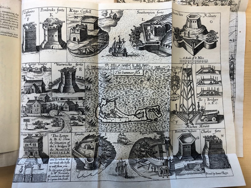 Map of the Summer Isles from The Generall Historie of Virginia, New England, and the Summer Isles.
 This is a map depicting Bermuda. It is contained in the same book that contains the Map of Virginia as depicted by Captain John Smith. This map shows many of the forts and structures, as well as a small layout of the town. This is significant not only because of the fact that it shows the major structures on the island, but the importance placed on the illustrations of the forts helps to understand what was most important to the English. These illustrations are evidence of how crucial security was to the English. They were trying to ensure their safety because they were worried about potential Spanish attacks. This helps us to contextualize the cautious and protective nature of the English during their settlement of Bermuda. (Brillante)
-
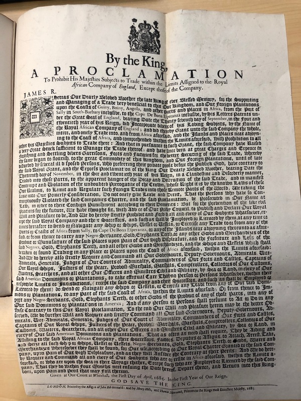 A Proclamation to Prohibit His Majesties Subjects To Trade within the Limits Assigned to the Royal African Company of England, Except Those of the Company
 This Proclamation prohibited trade outside of the Royal African Company. It helped to monopolize all trade amongst the colonies. This is significant because it demonstrates England’s desire to control its colonial imports and exports. This is how the English decided to cope with the idea of needing to more closely control the colonies. It was important that all trade that took place happen only within England’s control. This would encourage economic growth in England, but it also stagnated the opportunities of those living in the colonies. This shows the amount of control that the English sought to have over their colonies. (Brillante)
 Nova Virginia Tabula "Nova Virginia Tabula" is a map of Virginia by Herman Moll in his written work "The World Described." Maps offer an interesting historical perspective because they often show what the map creators considered were important. In this case Moll's map provides a detailed visual representation of Virginia's settlements, especially when it comes to those of indigenous people. The map also consists of illustrations of indigenous peoples. The illustrations depict the natives as technologically backwards but also as noble and proud. This perspective of indigenous peoples was popular during the early colonization of North America and it often led to belief that the natives should be both christianized and civilized by European colonists. Hakluyt argued that the English should colonize in order to prevent the Spanish from converting the indigenous communities to Catholicism before they arrived. The map also has an illustration of what seems to be an indigenous gathering titled, "Status Regis Powhatan" or "The Status of King Powhatan." Powhatan is depicted as powerful and respected with many subjects gathered at his court. -Henry
 The bad life, qualities and conditions of Pyrats; and how they taught the Turks and Moores to become men of warre Propagandized account of how English pirates influenced the Moorish and Turkish militaries in the late 16th and early 17th centuries. It is by title a description of how English Pirates influenced the Turks and Moores, but in reality is blanket criticism of their purpose and way of life. Smith in his account of pirates resorts to name calling and paints the pirates as scum and villains. He ascribes to them base characteristics and states they abandoned the plantation mission of the New World in favor of plunder. Smith in his closing remarks paints a picture of Carolinan and Virginian planters returning to England very wealthy, with the pirates teeming jealousy. The author is propagandizing the planter lifestyle in the hopes of, if not persuading pirates to abandon their vocation, then at least convince the public that farming was the better option.
 The manner how the Christians become Buforman Hakluyt in this paragraph is detailing how easy it is for an English man living in Turkey to adopt native religion and custom to the detriment of his own country's. The passage is inherently a warning against such heathen behavior and to not "go native." This story would go on to become a popular trope and add to the predominant outlook on English notions of cultural and religious superiority. Similarly, it served to cement the idea that religion determined whether you were English and consequently one's freedom. At the same time as Hakluyt published his book, James Thomson's "Rule, Brittania!" was incredibly popular in England. This song pioneered the idea that no Englishmen could ever be held in chattel slavery. As such the English had to turn to non-Christian and non-white people for slavery.
 Sundial adjustment directions This item is a set of images designed to help the reader to adjust their sundial to measure time correctly. The audience is specific to New England, Barbados, Jamaica, Virginia and Carolina. These directions were novel in the sense that that they were a direct result of the England's imperial growth; as such they were the first of their kind. They show that empire had expanded into different time zones and sent their people further than they ever had before. England was now a huge actor on the global stage and its citizens abroad were growing accustomed to the new power. The fact that the book that it was in, "A History of New-England. From the English Planting in the Yeere 1628. Untill the Yeere 1652", was so widely disseminated provides evidence for this growing acceptance. This item is an interesting footnote in the early growth of Imperial England.
 Map of New England and New York. A map of New England and New York created by Cotton Mather. Cotton Mather is the grandson of John Cotton, who was a puritan preacher that gave the sermon “Gods Promise to His Plantation” and It includes a scale (in English miles), a compass and locations of towns and villages, as well as geographical features. The map itself is not very different than previous maps because there weren’t very many developments since the creation of previous maps. The map is found in the book “Magnalia Christi Americana”, and it’s considered the first map of New England that was created in the 18thcentury. The “Magnalia Christi Americana” is a history of New England from its beginnings.
 Maps of England's Caribbean Colonies (1677) The first map is a very simple map of the English colony of Barbados with all of the cities labeled. The second map is a larger map of the Caribbean at the time, with a map of Jamaica blown up at the top. The last image is the title page of the book, "The Present State of New-England." William Hubbard's book serves as an informative source on England's early colonies in the Caribbean and America. Hubbard's book is one of the earliest sources that provides a history of England's colonies from 1607 to the year it was published, 1677.
 Acts & Laws of New Hampshire - Incest & Bastardy A 1716 law for the province of New Hampshire in New England that outlines the parameters of incest and the penalties for violating the law. The law on incest is very specific, defining all the possible relationships in which one might commit incest. If there is a marriage or child born of incest, such marriage or child is considered illegitimate or disabled. Violators of the law will be whipped, fined, and must wear the letter "I" on their clothes. There is also a separate law designed to protect bastard children and prevent their murders. The law makes it illegal for women or men to kill their bastard children in order to avoid shame or punishment.
 Title Pages of Joan Blaeu's "Geographia" The title page of Joan Blaeu's atlas written in Latin, "Geographia." Joan Blaeu was a Dutch cartographer, continuing the cartography legacy of his father, Willem Blaeu. The page following the publishers information is a drawing of the New World, "America." The drawing is centered around a naked Native woman with slaves working in the background, angels in the sky holding a banner that says "America," what appears to be Mary holding a cross, an anglo-european slaying a devil, and a ship docked in the background.
 Map of the Caribbean (1662) A detailed and colored map of the Caribbean islands, Southern North America, Central America, and Northern South America. The map illustrates Spain and Portugal's dominance in the New World in the early 17th century. The colors do not seem to signify which European power controlled the colony; colors appear only to represent borders of each colony.
 Map & Illustration of the Portuguese Colony Pernambuco (1660s) A map of the the Portuguese colony of Pernambuco that also includes a graphic illustration of the sugar production process used in South American and the Caribbean during the 17th century. The illustration shows the processes and early innovations in sugar production as well as the heavy reliance on African slaves. It is noteworthy to point out that although the main purpose of this image is to serve as a map of Pernambuco, the large and vivid illustration of sugar production above the map demonstrates the significance of sugar in South America at this time.
 "An Act Prohibiting Trade with the Barbado's, Virginia, Bermuda's, and Antego This source is an act of parliament that prohibited trade with Barbados, Virginia, Bermuda, and Antego. The Act was passed in 1650 during the height of the English Civil War between the Parliamentary forces and the Crown's royalist forces. Many planters and colonists saw their loyalties to the Crown as superseding their loyalties to Parliament and therefore sided with the Crown in the conflict. This stance is the source of Virginia's nickname who dubbed themselves the "Old Dominion" in support of Charles II while puritans in New England saw their loyalties tied to the predominately puritan parliament. Royal support was so strong in Barbados that after the Parliamentary victory over Charles II in 1651, Parliament sent an invasion force to Barbados to reassert state control over the colony. It represented the beginning of a new level of state power. -Henry
 Chapter XXVL: The first planting of Barbados This item is a description of early colonization of Barbados by Thomas Slater in his work, "The True Travels, Adventures, and Observations of Captain John Smith." The account begins with a geographic description of the location of Barbados and then writes that the first group of colonists were brought by Captaine Henry Powel and that the group contained "forty english, with seven or eight Negros....thirty Indians, men, women, and children." This is important because it shows that enslaved africans were a part of the original plan for Barbados, unlike in Virginia, where slavery emerged more slowly. Slater then goes on to describe the island as a place of great bounty possessing, "an infinite number of swine, some Turtles, and many sorts of excellent fish ; many great ponds wherein is Duck and Mallard ; excellent clay for pots, wood, and stone for building." It is clear that Slater is using his written works to encourage future colonization of Barbados. -Henry
 "An Act against Adultery and Polygamy" This passage is an act banning both polygamy and adultery in New England by the General Court or Assembly of His Majesties Province of New-Hampshire in New-England. Early colonial New England was a thoroughly puritan place and naturally it was a very strict and disciplined society. This act states, "Be it therefore enacted by the Lieutenant Governor, Council and Representatives, convened in General Assembly, and by the Authority of the Same, That if any Man be found in Bed with another Mans Wife, the Man and Woman so offending, being thereof Convicted, shall be severely Whipped." Most colonies followed English law based on precedent but the passage of a strict law against polygamy and adultery shows how much more involved New Englanders were in each other's personal lives than they were back in their home country of England.- Henry
 The Wonders of the Invisible World: Being an Account of the Tryals of Several Witches:
The Authors Defense Cotton Mather's observations on the trials of witches in New England. In the account of the trials, Mather aligns them to be devils. The evils the witches seek to spread are brought to a halt by the people of New England. Mather maps out the reaction of the Counsel to the activities of witchcraft, and sets out for improved action against the evil spirits that seek to bring down the English settlers. John Cotton was a puritan preacher. Cotton originally gave this sermon in England, specifically Southampton, when John Winthrop and other settlers of Massachusetts were set to leave for the new world in 1630. In 1632, Cotton was summoned to the high court, and instead of appearing, he went into hiding until he was able to travel to travel to Boston in 1633. Cotton distanced himself from Anne Hutchinson and her supporters (Henry Vane, John Wheelwright) in order to stay in power. Cotton later married into the Mather family and his grandson is Cotton Mather, a prominent figure in New England for years to come. Cotton’s sermon was particularly important in justifying Winthrop’s adventure to New England. In a way, it was a justification of Winthrop’s venture, and it was an argument for English presence in the Americas. The sermon was also an encouragement for other people to emigrate as well.
 A History of New-England From the English Planting in the Yeere 1618 untill the Yeere 1652 A mission statement for those spreading the Christian mission in New England. In this document we can identify the main goals of the English in their settlement. Outlined in the text are the acceptable means of behavior for the settlers. Their mission is mainly rooted in the establishment of community, and creating a heaven for the Puritan life.
 The History of New England Book VI.
A Brief Narrative of the Success which the Gospel hath had among the Indians of Martha's Vineyard, and the Places Adjacent in New England An account found within concerning the The History of New England discussing the successes of the English mission to spread Christianity to the Indigenous people of the New England. Their attempts to bring the Native people of the land into the light of Christ seem to be motivated to civilize the indigenous groups, and to instill in them the ways of proper Christian people.
 An Abstract of the Lawes of New England
Chapters VII-VIII In these documents we are able to observe the punishable crimes for the people of New England. The crimes are mainly focused on maintaining the order and civility of life in the settlements. Due to the intertwining of Church and Civil law we can see how life was centered around faith in the colony. Punishable offenses could result in anything up to banishment or death.
 Roger Williams' Romanticization of Rhode Island History (Excerpt from Callender) John Callender, clergyman, historian, and Harvard graduate (at age 20; he started at age 13), wrote this history of Rhode Island, and in the shown excerpt is a Roger Williams quote about Rhode Island's origin. As you can tell by the text, this narrative of Rhode Island is highly romanticized, describing Rhode Island as "obtained by Love," rather than with good Indian diplomacy after a religiously motivated banishing from Salem. On a historiographical note, it is also notable that the practice of history in the 18th century had a much larger focus on interviews with participants in the history than historical narratives do today
 A New and Correct Map of the World, Laid Down According to the Newest Discoveries and from the Most Exact Observations This map by geographer Herman Moll shows the world according to mainstream cartography, and therefore, shows how literate and educated Britons saw the world. An interesting (and possibly ironic) thing to notice is that the map is declared to be according to "the most exact observations," yet if that is true, there is a dearth of exact observations, at least of the kind that would be available to a London cartographer like Moll. According to the map, Canada's Pacific coastline doesn't exist and Ethiopia is one big "Unknown." In addition to unknowns, there are big errors: for one, there is a depicted land bridge between New Guinea and Australia, almost seeming to form a new continent. Nonetheless, the fact that such a detailed map was able to be produced only a couple hundred years after the New World was discovered is a testament to the speed of early European colonialism.
 "Gods Promise to His Plantations" Section on Samuel 7:10 These three pages are a section of John Cotton's sermon given to colonists settling Massachusetts. The sermon begins by quoting a bible verse where God promises to "appoint a place for [His] people Israel" where they will "move no more." The inclusion of this verse affirms that Cotton and the Puritans believed their quest to settle Massachusetts was both religiously motivated and divinely ensured. This worldview, where they are the clear protagonist, is one of the major reasons why Massachusetts Puritans saw King Philip’s War as such a terrifying moment for them. They thought, if God was on their side, and Massachusetts is Israel, why would He let them suffer? In addition, Cotton uses the phrase “my people” to describe the Puritans, making it quite obvious that he believes the Puritans are truly God’s people, not merely all Christians, and certainly not all people.
 Title Page of A History of New England The document A History of New England which was written by Edward Johnson depicts many pieces of history regarding New England from 1628-1652. This book explores everything from the declared form of government to the push to increase trade between the colonies and England. This is significant because it demonstrates the importance of the factors that shaped New England. Many of the events, and components depicted in this book help to tell the tale of what made New England unique. The wars, forms of government, contacts with Indigineous peoples, and desire to increase trade all add to the formation of New England as an independent place. These are the events that helped to create a special identity that defined New England. (Brillante)
 [A Proclamation Regarding the Royal African Company’s Monopoly]. This document is the royal charter for the Royal African Company. It set up the jurisdiction of the RAC as extremely broad from "South Barbary [on the North African Coast] to Cape de Bona Esperanza [the southern tip of Africa]." Not only was that their jurisdiction broad, but the RAC was given an official monopoly on Anglo-African trade. The English’s actual and regulated participation in African trade (especially slaves) was a big deal because of previous Iberian and Dutch dominance in that sphere. It also represents another shift in English policy—how close they should be to the actual enslavement of people. When the English had merely bought or stolen slaves from Iberians, they never considered themselves to be “making” slaves, only taking slaves. They weren’t guilty of enslaving anyone, technically, and their ownership would surely be preferable over the cruel Spanish papists, which is how the English viewed the Spaniards. Now though, the RAC would be on coasts paying money to actual slave raiders; were they not becoming more and more responsible for enslavement? But they had reasons not to care about ethics anymore—by 1674 (the date of this charter), the Barbadian economy was taking off and all the other colonies’ outputs were growing too. Cheap, “expendable” labor was needed and the issue could not wait for pirates to take slaves from Spanish ships.
 Map of New England found in The Generall Historie of Virginia, New England, and the Summer Isles. The map depicts the New England coast as described by Captain John Smith. This map was published in 1624, and shows all of the large established towns along the New England Coast. There are also depictions of large ships moving towards the coast, as well as a very large image of Captain John Smith in the upper corner. It is not so much the location of the towns that is important here, but instead what the creator of the map deemed important enough to place. The images that are depicted on the map explain a considerable amount of what they were trying to convey about the region. The somewhat embellished depictions of unicorns and leopards give an almost fairytale twist surrounding the entire region. Almost as though they are calling others to it. The map is so eloquently drawn that it is almost more a piece of art than a navigation tool. The large and imposing portrait of Captain John Smith also adds to an air of confidence and conquering spirit that embodied English motivation for colonization. (Brillante)
 Map of the Summer Isles from The Generall Historie of Virginia, New England, and the Summer Isles. This is a map depicting Bermuda. It is contained in the same book that contains the Map of Virginia as depicted by Captain John Smith. This map shows many of the forts and structures, as well as a small layout of the town. This is significant not only because of the fact that it shows the major structures on the island, but the importance placed on the illustrations of the forts helps to understand what was most important to the English. These illustrations are evidence of how crucial security was to the English. They were trying to ensure their safety because they were worried about potential Spanish attacks. This helps us to contextualize the cautious and protective nature of the English during their settlement of Bermuda. (Brillante)
 A Proclamation to Prohibit His Majesties Subjects To Trade within the Limits Assigned to the Royal African Company of England, Except Those of the Company This Proclamation prohibited trade outside of the Royal African Company. It helped to monopolize all trade amongst the colonies. This is significant because it demonstrates England’s desire to control its colonial imports and exports. This is how the English decided to cope with the idea of needing to more closely control the colonies. It was important that all trade that took place happen only within England’s control. This would encourage economic growth in England, but it also stagnated the opportunities of those living in the colonies. This shows the amount of control that the English sought to have over their colonies. (Brillante)