Map & Illustration of the Portuguese Colony Pernambuco (1660s)
Item
-
Identifier
-
Erfle2
-
Title
-
Map & Illustration of the Portuguese Colony Pernambuco (1660s)
-
Description
-
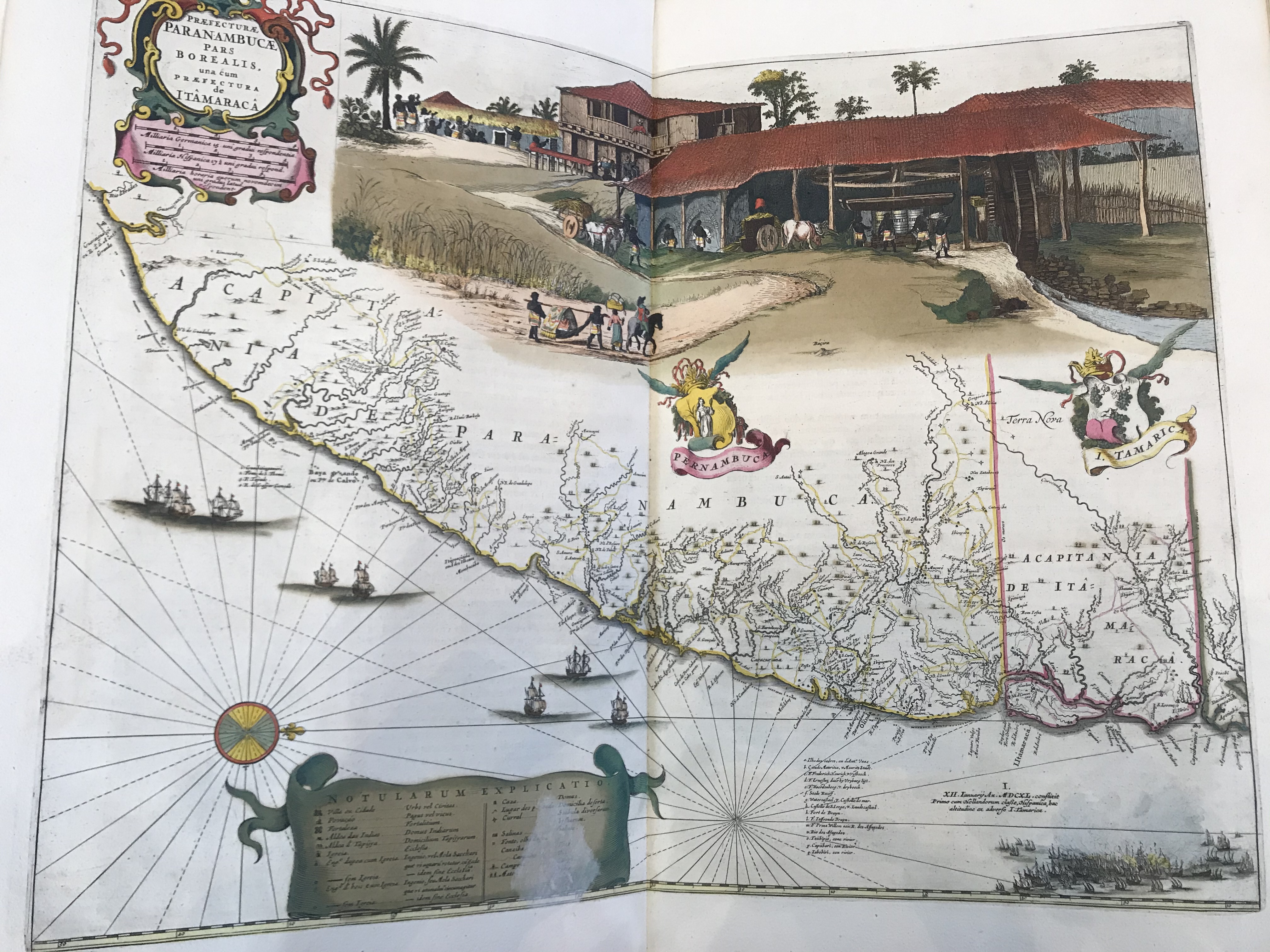
A map of the the Portuguese colony of Pernambuco that also includes a graphic illustration of the sugar production process used in South American and the Caribbean during the 17th century. The illustration shows the processes and early innovations in sugar production as well as the heavy reliance on African slaves. It is noteworthy to point out that although the main purpose of this image is to serve as a map of Pernambuco, the large and vivid illustration of sugar production above the map demonstrates the significance of sugar in South America at this time.
-
Creator
-
Joan Blaeu
-
Date Created
-
1662
-
Publisher
-
Amsterdam: Labore & Sumpitbus
-
Bibliographic Citation
-
Joan Blaeu. Geographia. Amsterdam, 1662.
 IMG_4948.jpeg