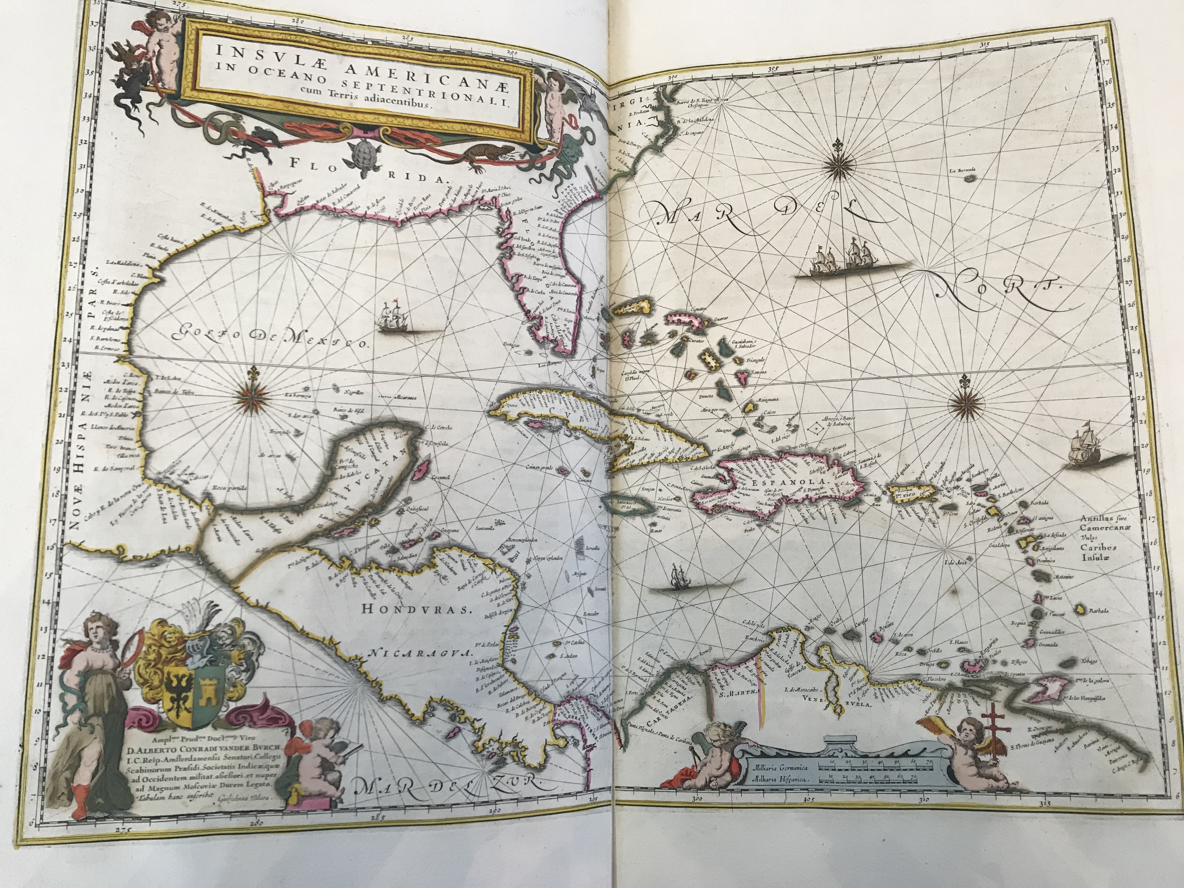
Map of the Caribbean (1662)
Item
-
Identifier
-
Erfle3
-
Title
-
Map of the Caribbean (1662)
-
Description
-
A detailed and colored map of the Caribbean islands, Southern North America, Central America, and Northern South America. The map illustrates Spain and Portugal's dominance in the New World in the early 17th century. The colors do not seem to signify which European power controlled the colony; colors appear only to represent borders of each colony.
-
Creator
-
Joan Blaeu
-
Date Created
-
1662
-
Publisher
-
Amsterdam: Labore & Sumpitbus
-
Bibliographic Citation
-
Joan Blaeu. Geographia. Amsterdam, 1662
 IMG_4950.jpeg