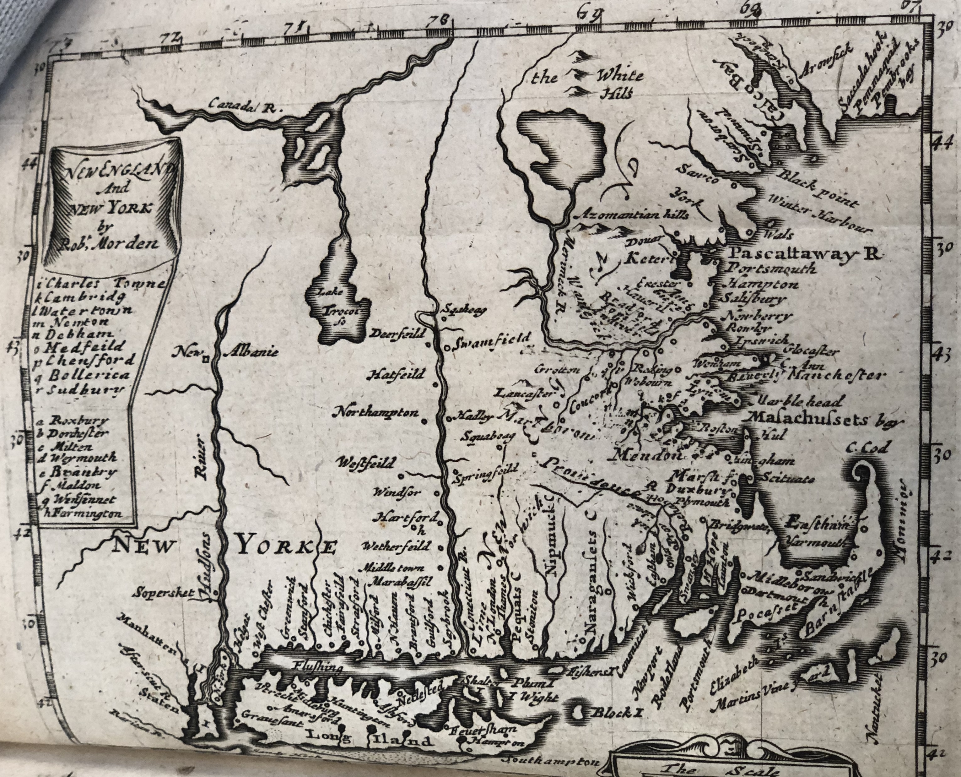
Map of New England and New York.
Item
-
Identifier
-
Wisdom 2
-
Title
-
Map of New England and New York.
-
Description
-
A map of New England and New York created by Cotton Mather. Cotton Mather is the grandson of John Cotton, who was a puritan preacher that gave the sermon “Gods Promise to His Plantation” and It includes a scale (in English miles), a compass and locations of towns and villages, as well as geographical features. The map itself is not very different than previous maps because there weren’t very many developments since the creation of previous maps. The map is found in the book “Magnalia Christi Americana”, and it’s considered the first map of New England that was created in the 18thcentury. The “Magnalia Christi Americana” is a history of New England from its beginnings.
-
Creator
-
Edward Johnson
-
Date Created
-
undated
-
Publisher
-
England: printed for Nath: Brooke at the Angel in Corn-hill
-
Bibliographic Citation
-
Johnson, Edward. A History of New-England. From the English Planting in the Yeere 1628. Untill the Yeere 1652. Declaring the Form of Their Government, Civill, Military, and Ecclesiastique. Their Wars with the Indians, Their Troubles with the Gortonists, and Other Heretiq. England: printed for Nath: Brooke at the Angel in Corn-hill, n.d.
 IMG_1092 2.jpg