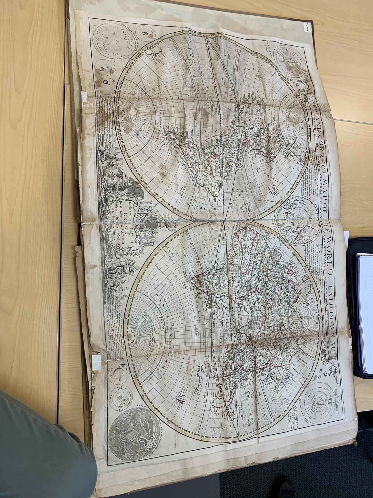
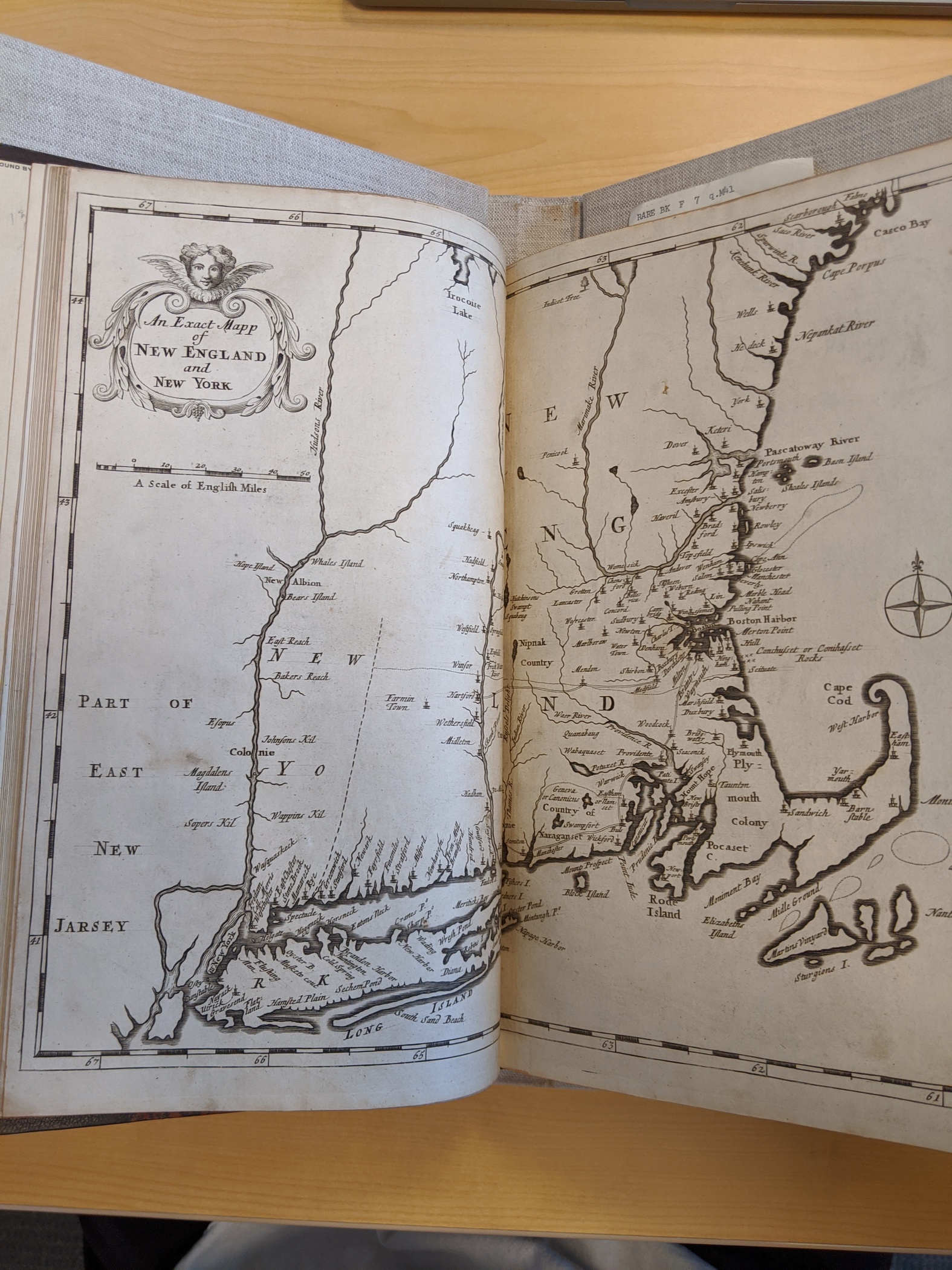
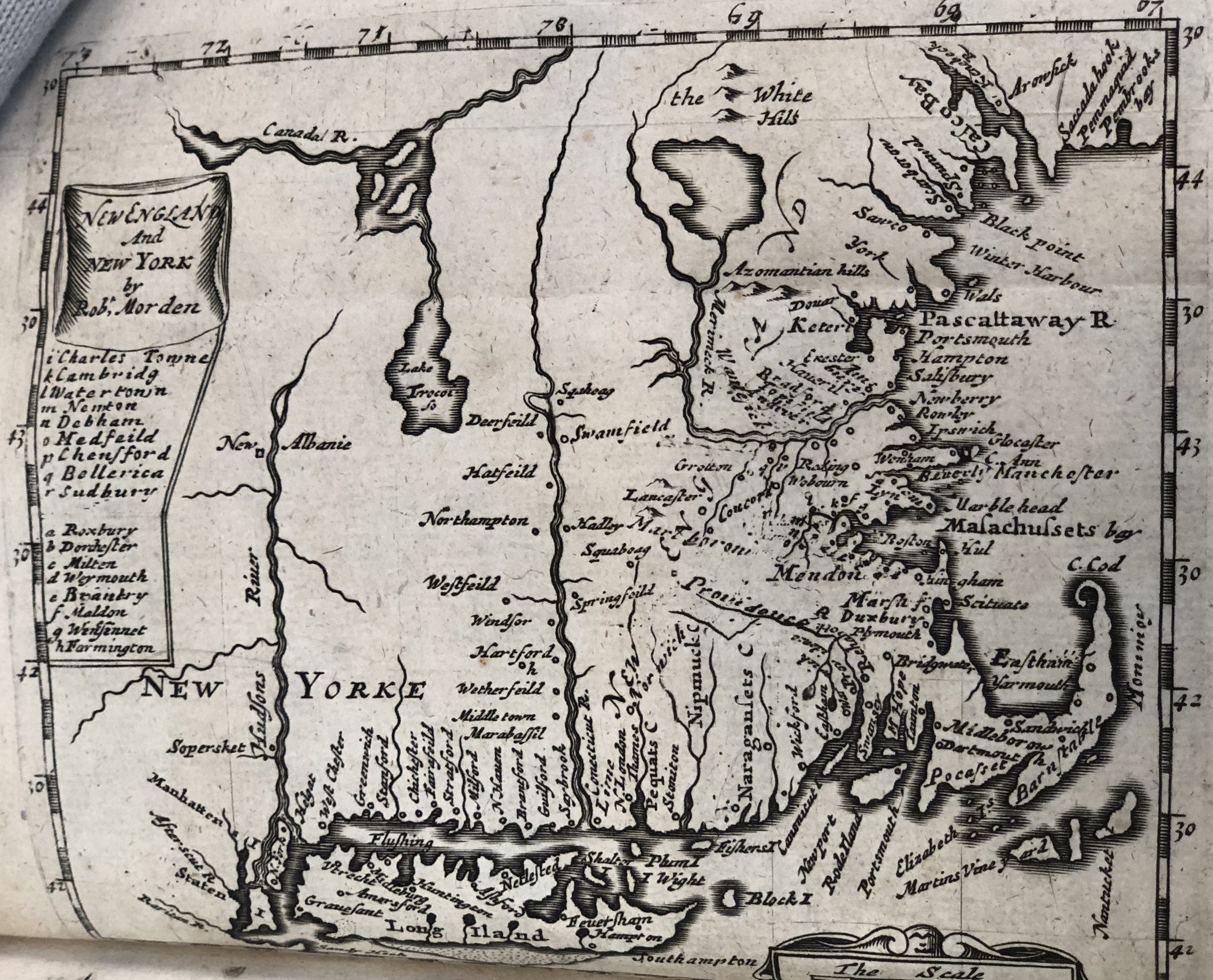
Maps show how people understand their world. This can be localized, as in a map of one's individual colony (see "Nova Virginia Tabula"), or global (see "A New and Correct Map of the World"), but both reveal important things about the worldview of the 17th century colonists. For example, in a localized map like An Exact Mapp of New England and New York, one can notice the presence (and lack theoreof) of Indigenous groups. There is an "Irocois Lake" at the top, but there is no obvious mention of the Lenape, choosing to not label vast amounts of land rather than labeling them "Indigenous Territory" or "Lenape Country." In a more global map like "A New and Correct Map of the World," one can see the amount of "Unknown" in Africa contributing to the easiness with which the English enslaved Africans in the 17th century.
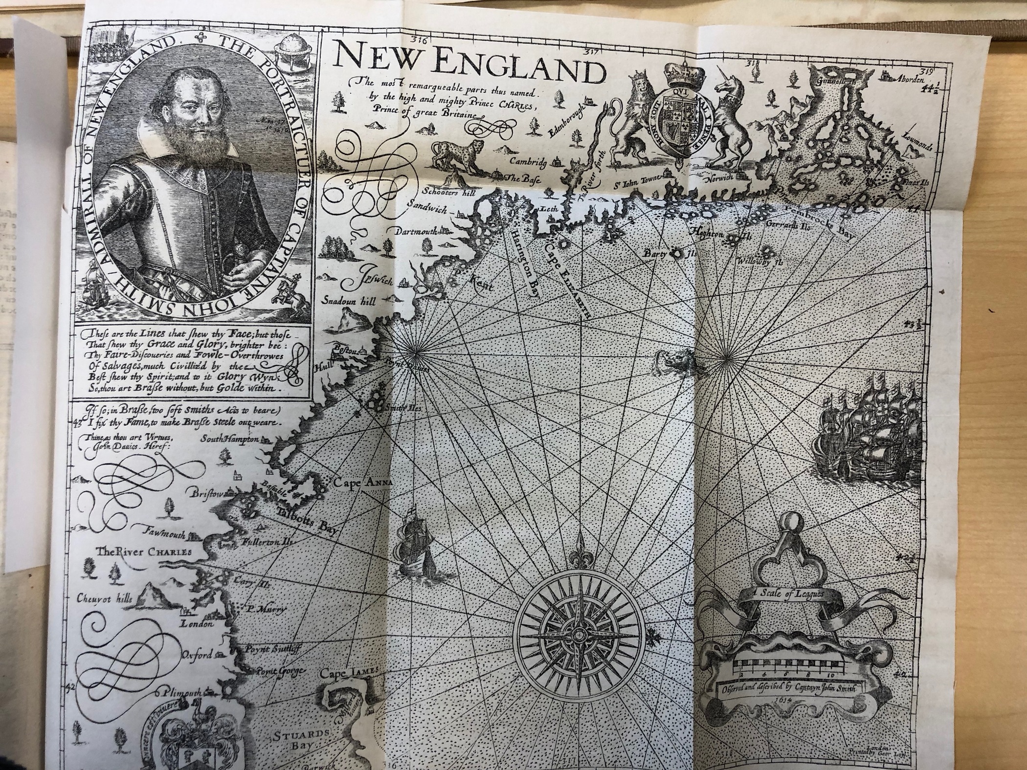
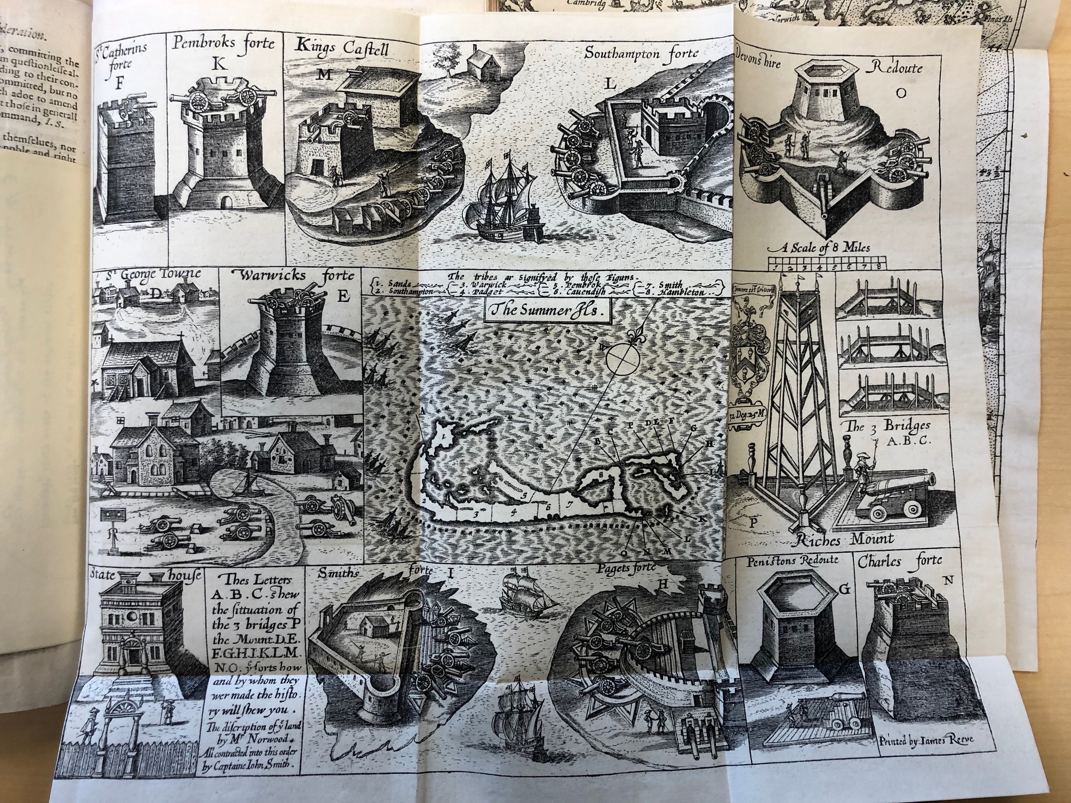
Beyond racial groups, maps can show us themes about English colonialism. Maps like "Map of New England found in the General Historie..." show the centrality of the coast to New England colonial society. "Map of the Summer Isles" shows the different forts of Bermuda, stressing the militarism and fragility of early English society in the Caribbean.
Feel free to peruse the items below. Descriptions of each map (around 150 words) can be found in the metadata of each item, which can be accessed by clicking the item. The pictures can be enlarged and zoomed once clicked from the metadata page. Enjoy!
(Marc Novicoff, 1st half introduction and page design)
Maps also offer unique insight into countries' imperial goals, which often conflicted with one another. For instance, the "Dutch Map of Hispaniola" was produced by the Dutch in order to better help English/Dutch navigation abilities in the New World. The Spanish who had a greater wealth of knowledge in the area, sequestered their maps in royal repositories in Spain to the detriment of other countries. Spain and England had been enemies since the latter adopted Protestantism as their national religion. As a result, the Puritanical English had made it their holy mission to raid Spanish slave and gold ships. Naturally in this tense era between these countries, there was not a ready dissemination of information. Thus, the Dutch and English as the two members of the informal Puritan Alliance created their own maps.
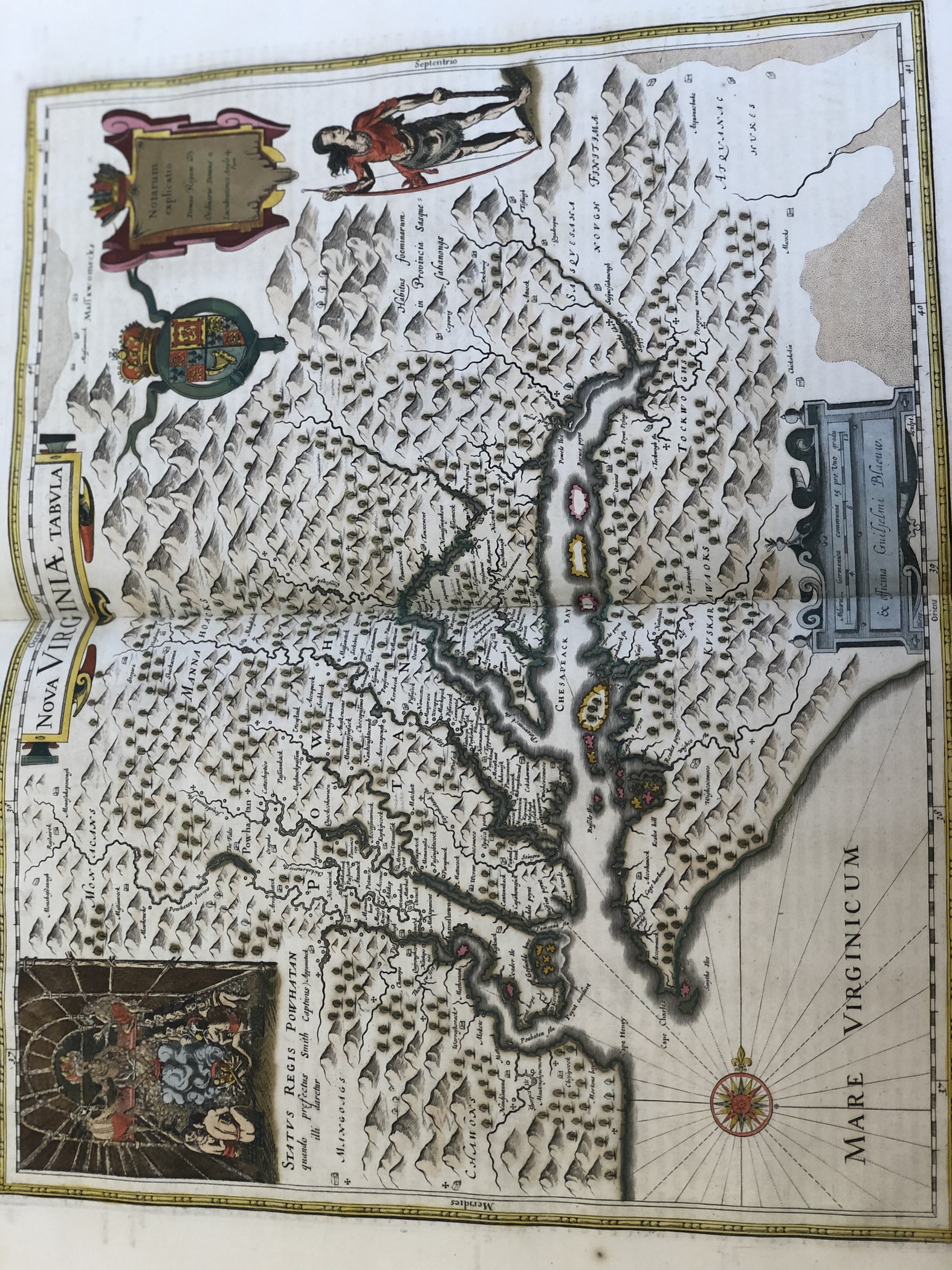
The choice of location for a map, provides insight into the imperial aims for countries as well. The English created numerous maps, some of which are displayed here, that demarcate the northeastern corner of North America, Virginia, The Carolinas, and much of the Caribbean. It is perhaps obvious in stating, but nonetheless important, that these maps were of paramount importance for these early colonists as well as the traders who would later voyage there. For example the "Nova Virginia Tabula" and the "An Exact Mapp of New England and New York" were the most current and accurate maps of the areas of New England and Virginia. England needed these maps to be good, because they wanted these areas to be settled. It connected to their vision of winning the battle against Spain in both religious superiority and in hegemonic status. These maps were the cornerstone to insuring that their imperial success was guaranteed.
This marks the end of "Maps", "Religious Thought" is the next.
(Ben Wisdom)